-8%


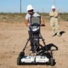
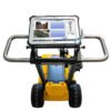
Stanlay IDS RIS MF Hi-MOD GPR

Original price was: ₹180,000.00.₹165,000.00Current price is: ₹165,000.00.
The RIS Hi-MOD represents the latest generation technology in highly modular Multi frequency array based GPR for providing highly accurate mapping of utilities.
The RIS Hi-MOD utilizes up to 4 Dual frequency antennas (operating at 200 MHz and 600 MHz) antennas (i.e. up to 8 channels) and is based on a cart system that is 2.0m wide, providing max walking speed up to 10km/hr. The RIS MF is unique in providing the field procedure of making both longitudinal and transversal scans in one go.
Features
- Deep and shallow antennas in one compact box: Two antennas in the same box, with the option of choosing 200 MHz & 600MHz or 400 MHz & 900MHz, help the operator to locate pipes and cables by providing the proper frequency for a specific search parameter. It provides a real-time display of deep and shallow antennas on the same screen.
- Modular: Antenna boxes can be quickly added in “chain connection” while in the field (no tools required) with up to 8 in operation simultaneously. As a result, the system is able to work in any available space.
- 3D Radar Tomography: Multi-frequency data fusion and a consolidated procedure to collect the data enable accurate 3D images of the subsurface to be achieved, helping the operator to distinguish individual anomalies and buried targets.
- Professional Utility Mapping Capability: The result can be exported in several formats including GIS and CAD (AutoCAD or MicroStation) for a professional survey.
- Flexible: Powered by the IDS Multi-channel Control unit, the system can be used to drive every IDS antenna.
The system is based on a central high powered processing system controller connected to multiple antennas, connected in a chain architecture to carry out high resolution capture, collation and processing of underground utility data over large areas which can be exported to CAD for mapping in 2D/3D.
Specification
| Radar Acquisition unit | IDS DAD FAST WAVE, with RIS K2 acquisition software |
| Max Number of channels | Up to 8 |
| Antenna Frequencies | 200-600MHz |
| Positioning | Metric wheel and/or GPS interface |
| Collection Speed | 3.77m/sec in full configuration (8 channels) |
| Max. Scan Rate | 4760 Scan/Sec |
| Battery operation time | >8h |
| Weight | 58 kg full configuration (i.e 4 Antennas) |
| Size on ground | 200 cm x 60 cm (full configuration) |
| Survey path width | Up to radar scans, 52 cm each |
| Wireless connection | Available |
| Environment | IP65 |
| Data Logger | Tough book laptop |
| Item Code | ST-RIS-HIMOD |
| Hardware Details | |
|
|
|
|
|
|
|
|
|
|
The trolley has been designed for both asphalt and rough terrain. |
|
|
|
| Software Details | |
| Advanced GRED 3D Post processing software provided with system capable of | |
|
|
|
|
|
|
|
|
|
|
|
|
Only logged in customers who have purchased this product may leave a review.
Related products
-23%


Fiber Testing Measurements Devices
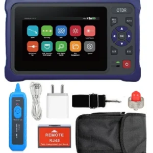
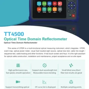
TECHTEST OTDR TT4500 – Multifunction Optical Time Domain Reflectometer
Original price was: ₹31,000.00.₹24,000.00Current price is: ₹24,000.00.
-19%

Fiber Testing Measurements Devices
DEVISER AE3100F Handheld OTDR | Dual/Quad Wavelength Fiber Tester | 45dB Range
Original price was: ₹290,000.00.₹235,680.00Current price is: ₹235,680.00.
-14%


Fiber Testing Measurements Devices
Original price was: ₹122,000.00.₹105,000.00Current price is: ₹105,000.00.
-21%
Fiber Testing Measurements Devices
DEVISER AE3100B OTDR – Dual/Quad Wavelength Handheld Fiber Tester
Original price was: ₹110,000.00.₹86,680.00Current price is: ₹86,680.00.
-19%
Fiber Testing Measurements Devices
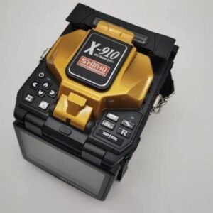
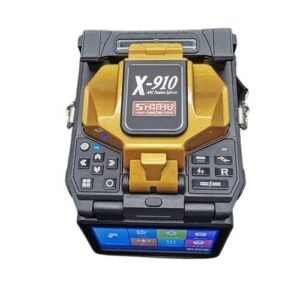
Shinho X-910 Core to Core Fusion Splicer – 6 Motors, Fully Automatic, 6s Splicing
Original price was: ₹135,000.00.₹110,000.00Current price is: ₹110,000.00.
-15%
Fiber Testing Measurements Devices
Techtest TT4500 OTDR – Dual Wavelength Optical Time Domain Reflectometer
Original price was: ₹25,450.00.₹21,600.00Current price is: ₹21,600.00.
-14%


Fiber Testing Measurements Devices
Original price was: ₹99,000.00.₹85,000.00Current price is: ₹85,000.00.
-34%
Fiber Testing Measurements Devices
DEVISER OTDR AE3100D- Handheld Optical Time-Domain Reflectometer
Original price was: ₹240,000.00.₹158,680.00Current price is: ₹158,680.00.
-27%


Fiber Testing Measurements Devices
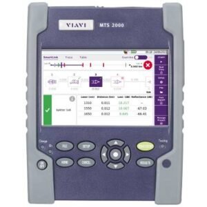
VIAVI T-BERD/MTS-4000 V2 OTDR Platform for Fiber Network Testing
Original price was: ₹565,000.00.₹414,000.00Current price is: ₹414,000.00.
-10%


Fiber Testing Measurements Devices
Original price was: ₹124,000.00.₹111,000.00Current price is: ₹111,000.00.
-31%

FIBER FAULT LOCATER & IDENTYFIER
Original price was: ₹8,999.00.₹6,200.00Current price is: ₹6,200.00.
-17%
Fiber Testing Measurements Devices
Original price was: ₹365,000.00.₹302,500.00Current price is: ₹302,500.00.
-7%
Fiber Testing Measurements Devices
VIAVI OTDR T-BERD/MTS-4000-E4126B Handheld Modular Fiber Test Platform
Original price was: ₹451,000.00.₹419,000.00Current price is: ₹419,000.00.
-10%
Fiber Testing Measurements Devices
DEVISER OTDR AE3100C Handheld -Dual/Quad Wavelength Fiber Tester
Original price was: ₹140,000.00.₹125,680.00Current price is: ₹125,680.00.
-20%
Fiber Testing Measurements Devices
DEVISER OTDR -AE3100E Handheld OTDR 1310/1550nm 43dB Dynamic Range
Original price was: ₹280,000.00.₹222,680.00Current price is: ₹222,680.00.
-38%

Fiber Testing Measurements Devices
Uniway OTDR UW-5000H – Handheld Optical Fiber Tester with VFL, OPM
Original price was: ₹99,000.00.₹61,000.00Current price is: ₹61,000.00.
-8%

Fiber Testing Measurements Devices
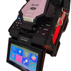
BME Fusion Splicer BM-97 – Core/Cladding Alignment, Handheld Splicing Machine
Original price was: ₹119,000.00.₹109,000.00Current price is: ₹109,000.00.
-23%

Fiber Testing Measurements Devices
Original price was: ₹385,000.00.₹295,000.00Current price is: ₹295,000.00.
-27%
Fiber Testing Measurements Devices
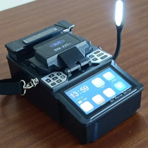
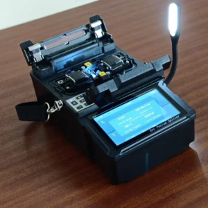
BME 22s+ Fiber Optic Splicing Machine – Fully Automatic, Core Alignment
Original price was: ₹99,000.00.₹72,500.00Current price is: ₹72,500.00.
-4%

Fiber Testing Measurements Devices
VIAVI OneAdvisor 800 – All-in-One Network Test Platform for Up to 400G
Original price was: ₹545,000.00.₹521,000.00Current price is: ₹521,000.00.
-21%
Fiber Testing Measurements Devices
DEVISER AE3100A OTDR – High Performance Handheld OTDR for FTTx & Network Testing
Original price was: ₹110,000.00.₹86,680.00Current price is: ₹86,680.00.
-10%

Fiber Testing Measurements Devices
Original price was: ₹161,000.00.₹145,000.00Current price is: ₹145,000.00.


-32%

Fiber Testing Measurements Devices
Original price was: ₹68,000.00.₹46,500.00Current price is: ₹46,500.00.
-14%

Fiber Testing Measurements Devices
Signal Fire Splicing Machine AI-9 – 6 Motor Core Alignment, Fully Automatic
Original price was: ₹115,000.00.₹99,000.00Current price is: ₹99,000.00.
-24%
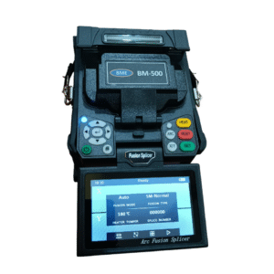
Fiber Testing Measurements Devices
BME BM-500 Splicing Machine – Core-to-Core Fiber Alignment, Handheld, High-Precision
Original price was: ₹89,000.00.₹67,500.00Current price is: ₹67,500.00.
-25%

Fiber Testing Measurements Devices
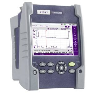
VIAVI T-BERD/MTS-8000 Platform – Scalable Test Solution for High-Speed Networks
Original price was: ₹845,000.00.₹635,000.00Current price is: ₹635,000.00.
Reviews
There are no reviews yet.